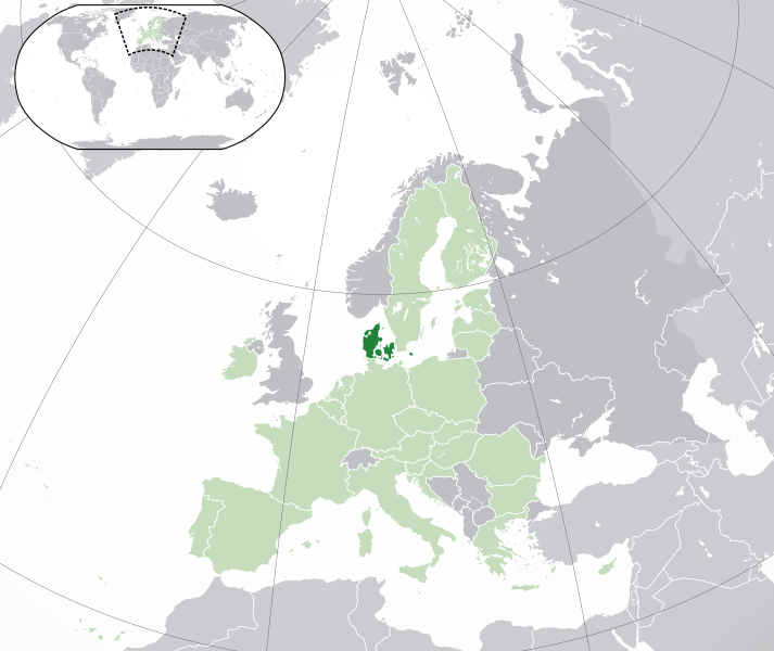
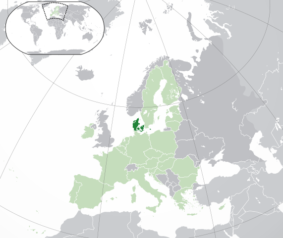
Fitxategi:EU-Denmark.svg

SVG fitxategi honen PNG aurreikuspenaren tamaina: 713 × 600 pixel. Bestelako bereizmenak: 285 × 240 pixel | 571 × 480 pixel | 913 × 768 pixel | 1.218 × 1.024 pixel | 2.435 × 2.048 pixel | 2.045 × 1.720 pixel.
Jatorrizko fitxategia (SVG fitxategia, nominaldi 2.045 × 1.720 pixel, fitxategiaren tamaina: 7,33 MB)
Laburpena
| Deskribapena | |
| SVG genesis | Fitxategi hau (bektore-irudia) hau Inkscape-ekin sortu da .
. |
| Data | |
| Jatorria | Norberaren lana, ondorengo hau(ek) oinarri hartuta: Location European nation states.svg |
| Egilea | NuclearVacuum |
| Beste bertsioak |
|
| SVG genesis | handi Fitxategi hau (bektore-irudia) hau Inkscape-ekin sortu da .
. |


Lizentzia
Nik, lan honen egileak, argitaratzen dut ondorengo lizentzia hauen pean:
Fitxategi hau Creative Commons Attribution-Share Alike 3.0 Unported lizentziapean dago.
- Askea zara:
- partekatzeko – lana kopiatzeko, banatzeko eta bidaltzeko
- birnahasteko – lana moldatzeko
- Ondorengo baldintzen pean:
- eskuduntza – Egiletza behar bezala aitortu behar duzu, lizentzia ikusteko esteka gehitu, eta ea aldaketak egin diren aipatu. Era egokian egin behar duzu hori guztia, baina inola ere ez egileak zure lana edo zure erabilera babesten duela irudikatuz.
- berdin partekatu – Lan honetan oinarrituta edo aldatuta berria eraikitzen baduzu, emaitza lana hau bezalako lizentzia batekin argitaratu behar duzu.

|
Baimena duzu dokumentu hau kopiatu, banatu edo/eta aldatzeko GNU Free Documentation License baldintzapean, Free Software Foundationek argitaratutako 1.2 edo ondorengo bertsioan; sekzio aldaezinik gabe, azaleko testurik gabe, eta atzeko azaleko testurik gabe. Lizentziaren kopia dago GNU Free Documentation License izenburudun atalean. |
Nahiago duzun lizentzia erabil dezakezu.
Fitxategiaren historia
Data/orduan klik egin fitxategiak orduan zuen itxura ikusteko.
| Data/Ordua | Iruditxoa | Neurriak | Erabiltzailea | Iruzkina | |
|---|---|---|---|---|---|
| oraingoa | 04:49, 1 otsaila 2020 | | 2.045 × 1.720 (7,33 MB) | Rob984 | UK and Gibraltar have left the EU. New base which includes all of Portugal's islands within frame, as well as Arctic Russian islands part of Europe. Also fixed Flevoland in the Netherlands. |
| 19:24, 25 urria 2016 |  | 2.045 × 1.720 (7,32 MB) | Giorgi Balakhadze | fix | |
| 16:37, 25 urria 2016 |  | 2.045 × 1.720 (7,33 MB) | Giorgi Balakhadze | Rv of sockpuppet and per COM:OVERWRITE | |
| 14:46, 21 otsaila 2015 |  | 2.045 × 1.720 (7,38 MB) | Hazhk | Reverted to version as of 19:20, 19 November 2014 | |
| 14:05, 21 otsaila 2015 |  | 2.045 × 1.720 (7,38 MB) | VS6507 | Spain. Greece. Slovakia. Cyprus. Romania VETO | |
| 19:20, 19 azaroa 2014 |  | 2.045 × 1.720 (7,38 MB) | Leftcry | Reverted to version as of 19:36, 16 November 2014 Stop making such edits without consensus! Start a discussion on the talk page first! | |
| 11:09, 19 azaroa 2014 |  | 2.045 × 1.720 (7,38 MB) | Mondolkiri1 | Correcting one island in Norway, therefore, also in the Nordic Council | |
| 10:30, 19 azaroa 2014 |  | 2.045 × 1.720 (7,38 MB) | Mondolkiri1 | Corrections about some islands belonging to Norway, therefore, to the Nordic Council. | |
| 10:22, 19 azaroa 2014 |  | 2.045 × 1.720 (7,38 MB) | Mondolkiri1 | Correction about some islands in Norway, therefore, in the Nordic Council | |
| 06:45, 19 azaroa 2014 |  | 2.045 × 1.720 (7,38 MB) | Mondolkiri1 | Reverted to version as of 21:59, 18 November 2014 Sorry but this map is far more logic since Greenland and the Faroe Islands belong to Denmark and Nordic Council but not to EU! Don't be like an Eurocrat supremacist, please! |
Fitxategiaren erabilera
Fitxategi hau darabil ondorengo orri honek:
Fitxategiaren erabilera orokorra
Hurrengo beste wikiek fitxategi hau darabilte:
- ady.wikipedia.org proiektuan duen erabilera
- af.wikipedia.org proiektuan duen erabilera
- ar.wikipedia.org proiektuan duen erabilera
- الدنمارك
- بوابة:الدنمارك/واجهة
- بوابة:الدنمارك
- مستخدم:ElWaliElAlaoui/ملعب 8
- معاملة المثليين في الدنمارك
- مستخدم:جار الله/قائمة صور مقالات العلاقات الثنائية
- العلاقات الأنغولية الدنماركية
- العلاقات الدنماركية الكورية الجنوبية
- العلاقات الدنماركية الإريترية
- العلاقات الدنماركية السويسرية
- العلاقات الدنماركية الليختنشتانية
- العلاقات الدنماركية البوليفية
- العلاقات الدنماركية الموزمبيقية
- العلاقات الألبانية الدنماركية
- العلاقات الدنماركية البلجيكية
- العلاقات الدنماركية الإثيوبية
- العلاقات الدنماركية البيلاروسية
- العلاقات الدنماركية الطاجيكستانية
- العلاقات الدنماركية الرومانية
- العلاقات الأرجنتينية الدنماركية
- العلاقات الدنماركية الغامبية
- العلاقات الدنماركية القبرصية
- العلاقات الدنماركية السيراليونية
- العلاقات الدنماركية النيبالية
- العلاقات الدنماركية الليبيرية
- العلاقات التشيكية الدنماركية
- العلاقات الدنماركية الميانمارية
- العلاقات الدنماركية الكندية
- العلاقات الدنماركية الزيمبابوية
- العلاقات الدنماركية الإسرائيلية
- العلاقات الدنماركية البالاوية
- العلاقات الدنماركية المالية
- العلاقات الدنماركية النيجيرية
- العلاقات الدنماركية اليمنية
- العلاقات الدنماركية الفانواتية
- العلاقات الدنماركية الغابونية
- العلاقات الدنماركية البنمية
- العلاقات الدنماركية الكوبية
- العلاقات الدنماركية الجورجية
- العلاقات الدنماركية التونسية
- العلاقات الدنماركية الكورية الشمالية
- العلاقات الدنماركية الهندية
- العلاقات الدنماركية اليابانية
- العلاقات الدنماركية الإيطالية
- العلاقات الدنماركية الناوروية
- العلاقات الأسترالية الدنماركية
- العلاقات الدنماركية الزامبية
- العلاقات الدنماركية الفيجية
Ikus fitxategi honen erabilpen global gehiago.